The origin of Welland is uncertain and little documentation exists for its early development. Medieval documents refer to it as Wenlond or Wellond, perhaps meaning that in Anglo-Saxon times the land belonged to someone called Wenna.
Prehistory
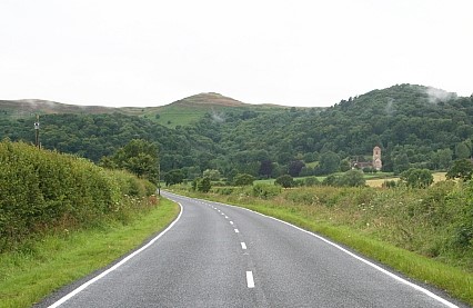
Although there is unlikely to have been any significant settlement here in prehistoric times, the village lies close to the ancient frontier of the Malvern Hills and is on the route from a crossing of the River Severn (at Upton) to the Iron Age hillfort at British Camp (now the A4104). Another Iron Age settlement has been found recently on the same route, on the other side of the river. It has been suggested that this settlement forms part of the system used by the local tribe, the Dobunni, to control the region, including the distribution of cereal harvests stored at sites in the Severn valley. The route extends on to Bredon Hill, yet another hillfort site. Thus the route passing through Welland may have been a significant part of the Dobunni Iron Age travel network. (See Worcestershire Archaeology report.)
An archaeological evaluation by Worcestershire Archaeology (unpublished) was undertaken at Cornfield Meadows in 2020 (see map) and revealed a number of enclosure ditches and associated features at the northern end of the site close to the Marlbank Brook and its tributaries. It was dated by pottery to the later Iron Age and is probably an enclosed prehistoric settlement located within the fertile farmland adjacent to the brook. Evidence of extensive burning was recovered, including both heat affected pottery and Malvernian rock. The Malvern area provided a major regional focus for Iron Age pottery production, with rock from the hills used to temper locally produced pottery. It was therefore tentatively suggested that the site might have an association with pottery production.
Medieval
The first documented reference to Welland states that the village, together with Upton, was given to the Bishop of Worcester by Mercian lords in 889, perhaps as part of their support for the developing Christian church (the document’s authenticity is disputed.) The area was heavily wooded and it is unlikely that many people lived here – as late as the twelfth century the area around Malvern was referred to as wilderness.
Welland is not mentioned in the Domesday Book of 1086, probably because it formed part of the manor of Bredon. Several parishes in the area were subsidiary parts of manors further east in the more agriculturally developed zone of the Severn and Avon valleys. The western parts of the estates provided wood for tools, utensils, fuel and building, as well as woodland resources such as honey and game. Woodland areas were also valuable for the pasturing of swine – it may be that this began as a form of transhumance, the seasonal movement of stock from predominantly agricultural areas for summer pasture. Thus the linking of Welland with Bredon was on a sound economic principle, that of complementary resources.
After the Norman Conquest of 1066, Welland was one of thirteen parishes that were incorporated into William the Conqueror’s Royal Forest, commonly known as Malvern Chase, and subject to forest law. The owner of the land (the Bishop of Worcester) and those living on the land were subject to rigorously enforced rules about the use of the land, which aimed to protect hunting rights. Some clearings had been made before the Conquest but after afforestation, no further clearings were allowed unless permitted by licence of the king.
34 acres in Upper Welland were freed from forest law by Richard I in 1189 and in 1196 the Bishop of Worcester was allowed to extend his clearing by a further 300 acres. Such clearance is called assarting and explains the existence of Assarts Road in Upper Welland. The assart was said to be “neare the Bishoppe’s myll of Wenlonde.” It seems that Upper Welland developed as a distinct community from early times, with another forming around the area near Welland Court.
Taxation assessments suggest that by 1280 approximately 80 people lived in the village, increasing to about 130 by 1327. The population was particularly dense in Upper Welland, perhaps because of the unusual economic approach of letting out assarted land to tenants for money rent. The standard land economy at this time was to let to tenants who paid their rent by manual labour on land (desmesne) retained by the lord of the manor (the Bishop in this case).
In the area around Welland Court, meanwhile, another community was developing along more traditional lines. There is little documentary evidence to support it, but it is likely that this community worked large open fields split into strips and apportioned to individual tenants, with the fields being managed on a crop rotation system. It may be that this community developed earlier than that at Upper Welland – though there is no documentary evidence to support this idea, the traditional agricultural approach and the presence of the Court and church suggest this may be so.
Peasants in the middle ages were mostly tenant farmers but there were also small-scale industries such as potting and tile-making (evidence of clay pits abounds).
The manor had probably been separated from Bredon before 1535 because, in the valuation of the bishop’s lands taken at that time, it is entered apart from Bredon and had a separate bailiff.
