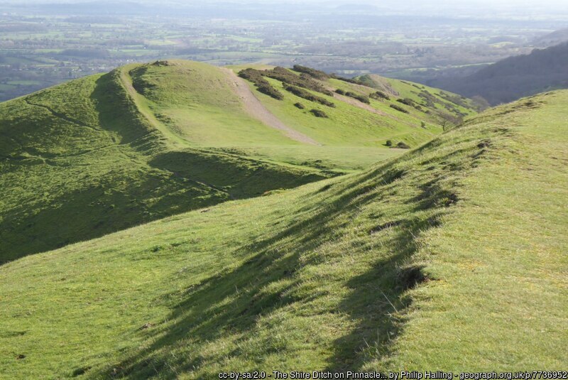
There is evidence of boundaries in the Welland area going back to pre-historic times. It is thought that the shire ditch along the crest of the Malvern Hills may have originated in the Bronze Age, and British Camp marks the western boundary of the Iron Age Dobunni tribe.
Anglo-Saxon Charters
The first reference to Welland as a named place with boundaries is not until Anglo-Saxon times. The first documented reference states that the village, together with Upton, was given to the Bishop of Worcester by Mercian lords in 889, perhaps as part of their support for the developing Christian church. This charter does not have any documented boundary clauses but there are two other local charters from the tenth century that do: Longdon of 972 and Upton of 962. These give us at least a partial view of Welland’s outline where the boundaries are shared. Natural features form a large percentage of landmarks chosen to mark estate boundaries. Where these are streams they form relatively stable features in the landscape but references such as “the crooked oak tree” (mentioned in the Upton charter) less so. Nonetheless, reviewing the charters enables an educated estimate of the eastern and southern boundary. It also strongly suggests that Mere Brook formed the northern boundary. Thus, much of the Anglo-Saxon boundary remains in today’s parish outline. However, there is little evidence of the line of the western boundary.
Perambulations
Before detailed maps came into existence, the local community would undertake an annual perambulation (beating of the bounds) in order to maintain the boundary in the shared memory. Knowing the exact boundary was important to a parish community – to avoid trespass, to provide for the poor (and not someone else’s poor), for taxation, tithes and land ownership. Welland and Little Malvern are fortunate in having a number of documented perambulations, so detailed that even the amount of food and drink consumed during them was written down. In 1810, this was 11½ pounds of bacon, 5½ pounds of cheese, 19½ pounds of beef, 14 gallons of cider, and 11 gallons of porter (stout). Following the boundary was done so thoroughly that this sometimes entailed rather odd behaviour – the 1828 perambulation clearly states that the community walked through Bakehouse Farm pond and then through Bakehouse Farmhouse, as both straddle the boundary between Welland and Castlemorton. What the owner thought of wet and muddy people tramping through his house was not documented.
Disputed Boundaries
It was quite unusual for perambulations to be written down and they have survived for only a small number of parishes. We are fortunate that we have a collection of three for Welland and twelve for Little Malvern from the 18th and 19th centuries. The fact that they were written down is indicative that something was amiss. A comparison of the perambulations shows that a considerable portion of what we now know as Little Malvern was a source of dispute between Little Malvern and the parishes of both Welland and Castlemorton. Those on the perambulations were accused of breaking down fences and trampling crops. Many of the issues can be linked to a description of the boundary of Welland made in 1648, produced during the turmoil of the civil war. It excluded any access to the hills, which seems to have been an ancient right. There were numerous efforts to resolve the dispute (which cost the respective parishes a considerable sum) and was only finally settled in 1850. Formalising access to the hills was important as it gave access to extract the stone – Berington Quarry is the legacy of this.
Boundary Markers and Maps
It was not until the nineteenth century that detailed maps were created that marked Welland’s boundary. The earliest we have found to date is the Christopher Greenwood’s 1822 map, and by 1850 the Welland tithe map had been published. However, each of them still struggles to define the western boundary. Prior to the detailed Ordnance Survey maps being produced from the 1880s, a variety of posts and boundary stones were used to delineate the boundary where it did not follow a stream – several of these can still be found on the disputed western edge.
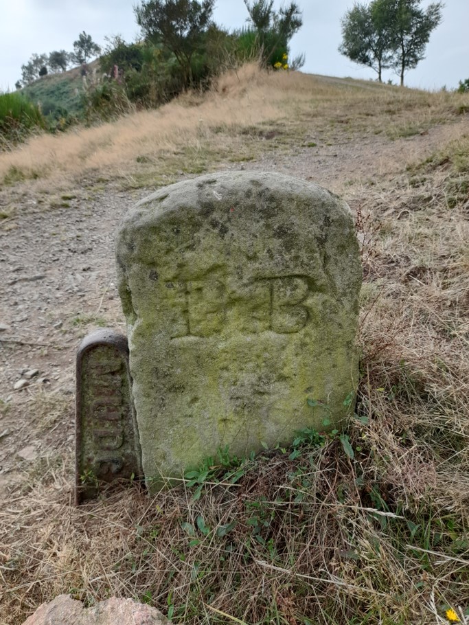
“MUDC”: Malvern Urban District Council
“DB”: defined boundary
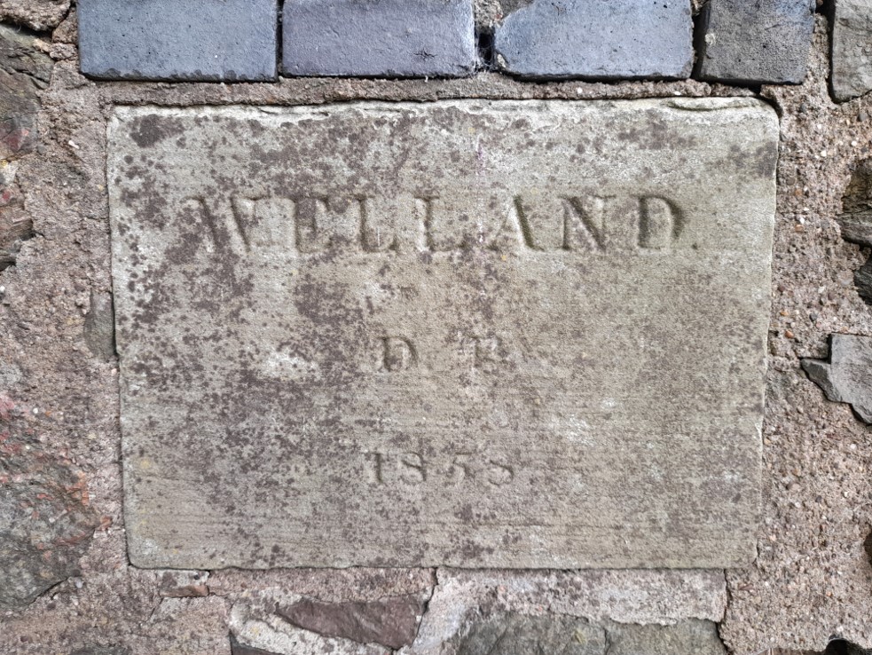
“WELLAND DB 1858”
Boundary Changes
Following the passing of the 1894 Local Government Act, civil parishes were created as separate entities to ecclesiastical parishes. As a consequence, Upper Welland was transferred from Welland to Malvern Wells civil parish in 1898. However, the equivalent change for the ecclesiastical parish, though discussed in 1915, was not completed until 1978. The civil parish and ecclesiastical parish are not exactly aligned so that a small section of Upper Welland is in one parish for civil purposes but another for ecclesiastical purposes.
