Turnpikes and Tollhouses

From the late 17th century, Parliament increasingly took responsibility for repairing and maintaining roads through Turnpike Trusts. Acts authorised a Trust to levy tolls on road users and to use the income to repair and improve the road. They could also purchase property to widen or divert existing roads.  The trusts were not-for-profit organisations and toll levels had a maximum set, so it was supposed to benefit everyone. The “turnpike” was actually the gate which blocked the road until the toll was paid, so when a road was referred to as being “turnpiked” it just meant that it had toll gates across it.

The first Turnpike Act of Parliament was in 1663 and it turnpiked part of the Great North Road. By 1772 local area trusts covered more than 11½ thousand miles of road. By the time the last Act was passed in 1836, there had been nearly a thousand Acts for new turnpike trusts in England and Wales, at which time turnpikes covered around 22 thousand miles of road – about a fifth of the entire road network.

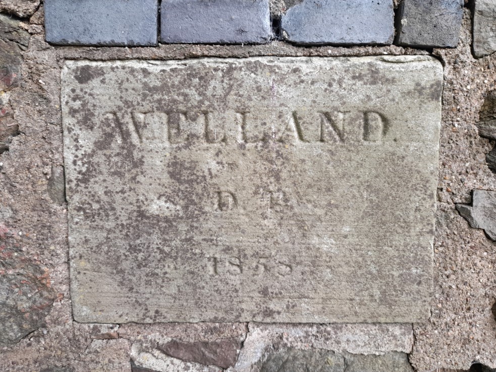
Locally, Welland was well served by turnpiked roads. The Upton-upon-Severn Trust included responsibility for Welland as part of the Worcester hub network, and the Ledbury Turnpike Trust (part of the Hereford hub network) linked into Worcester’s hub. 

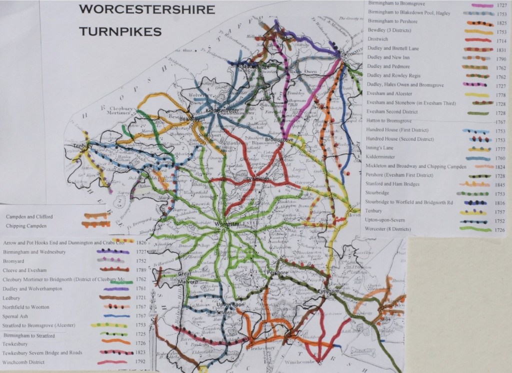
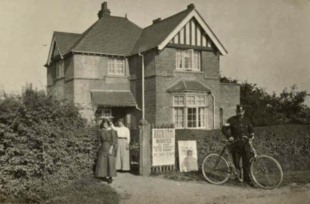
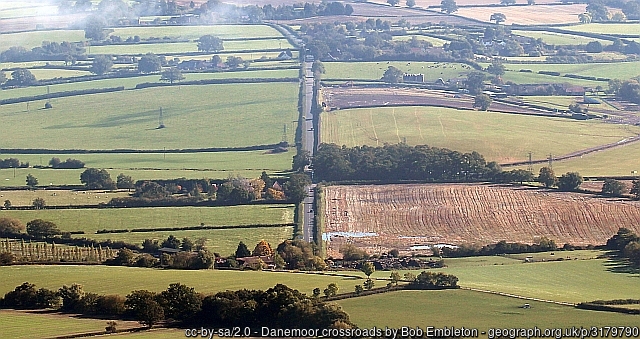
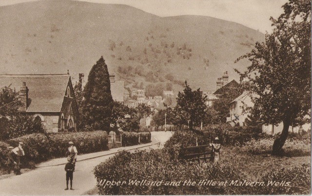
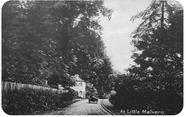
Welland had three tollhouses in close proximity, either in the parish or close to it. Little Malvern tollhouse on the A4104 was under the jurisdiction of the Upton Turnpike Trust, Twelve Mile Gate Cottage on the Malvern Wells road belonged to the Worcester Trust and the one just past The Malvern Hills Hotel beneath British Camp (see map) belonged to the Ledbury Turnpike Trust. Each tollhouse collected tolls for its own trust. Poet Elizabeth Barrett Browning made a reference to these three turnpikes in one of her diaries, writing that she had to pay at two tollgates when she went from home (near Wellington Heath) to visit her friend who lived at Malvern Wells, and if she also wanted to take the opportunity to drop down into Welland while in the vicinity, another toll charge would have to be paid.

Tollgates were often built at points were it was least likely that vehicles or horse users could evade payment, for example at bridges, crossroads or where the adjoining ground constricted the road. Hence many were built into a bank – as was the case with the three close to Welland. The tollhouses were generally placed outside urban areas.  This avoided imposing tolls on local people and maximised the collection of charges on long-distance travellers. A downside was that these more isolated sites were vulnerable to thieves and highwaymen, so the windows of the tollhouse would routinely be fitted with stout bars and have built-in safes to protect the cash kept inside. However, many simple buildings were also built to house the pikemen who manned the gates on lesser highways. The classic design of a single story cottage with angled frontages dates from the 1820s when turnpike roads and the coach traffic they carried were at their peak.

Although the tollhouse itself was often the most prominent feature of the fare stage, as important to the toll collector was the gate. These were built to bar free passage along the road and were generally stout and substantial.

In 1840 there were still over five thousand tollhouses in England, but travellers had already started switching to the quicker railways, resulting in toll receipts dropping by a quarter over a period of just four years (from 1837 to 1841).  In the 1870s, tollgates were opened to allow free passage – and just ten years later, the turnpike trusts ended and the tollhouses were gradually sold off. 

Turnpike Trusts were responsible for the upkeep of roads and ensured they had a regular income by letting the tollgates to individuals.  In some cases, tenants paid an annual rent to the trust and in return they were allowed to keep the tolls collected.  Other times, the tollhouse was provided rent free but occupiers would hand over the tolls.  It would appear from what we see on various census returns over the years that it was common for the wife to operate the toll gate and collect tolls during the day so the husband could work elsewhere.

The whole system of toll roads was very unpopular, as most people saw little improvement in the roads in the early days, found the frequent halts to pay the tolls very inconvenient and resented having to pay at all.  In fact, it has been recorded that Mr Berington, a local Welland landowner, objected to paying the tolls – so the Trustees instructed the surveyor to pay him a visit and “acquaint him that the Trustees require him to pay the tolls at the gate the same as everyone else”.

Old postcard of Little Malvern tollhouse

Little Malvern Tollhouse on the A4104 was built by the Upton-upon-Severn Turnpike Trust in 1822 at a cost of £56. It stood for over a hundred and fifty years at the top of the Welland to Upton Road just above Little Malvern Priory, after the sharp right hand bend but below the difficult junction with the A449 (see map).  Windows faced both ways, so that there was a clear view in both directions of approaching traffic. This tollhouse was gifted to The Avoncroft Museum of Buildings in Bromsgrove in 1985 by the Berington Court Estate – it was subsequently removed and re-built, then restored and furnished. The tollhouse is a two storey brick building with a rear rubble wall of Malvern stone.  The layout is somewhat quirky, being split level because it was built into a bank, so one enters the front at road level but exits the back door from the upper floor. During dismantling, a blocked up bread oven was discovered in the kitchen at the rear.  The tollhouse had a timber built ‘earth closet’ (outside privy) that was also taken and erected next to the tollhouse at the museum.

Little Malvern tollhouse at Avoncroft Museum

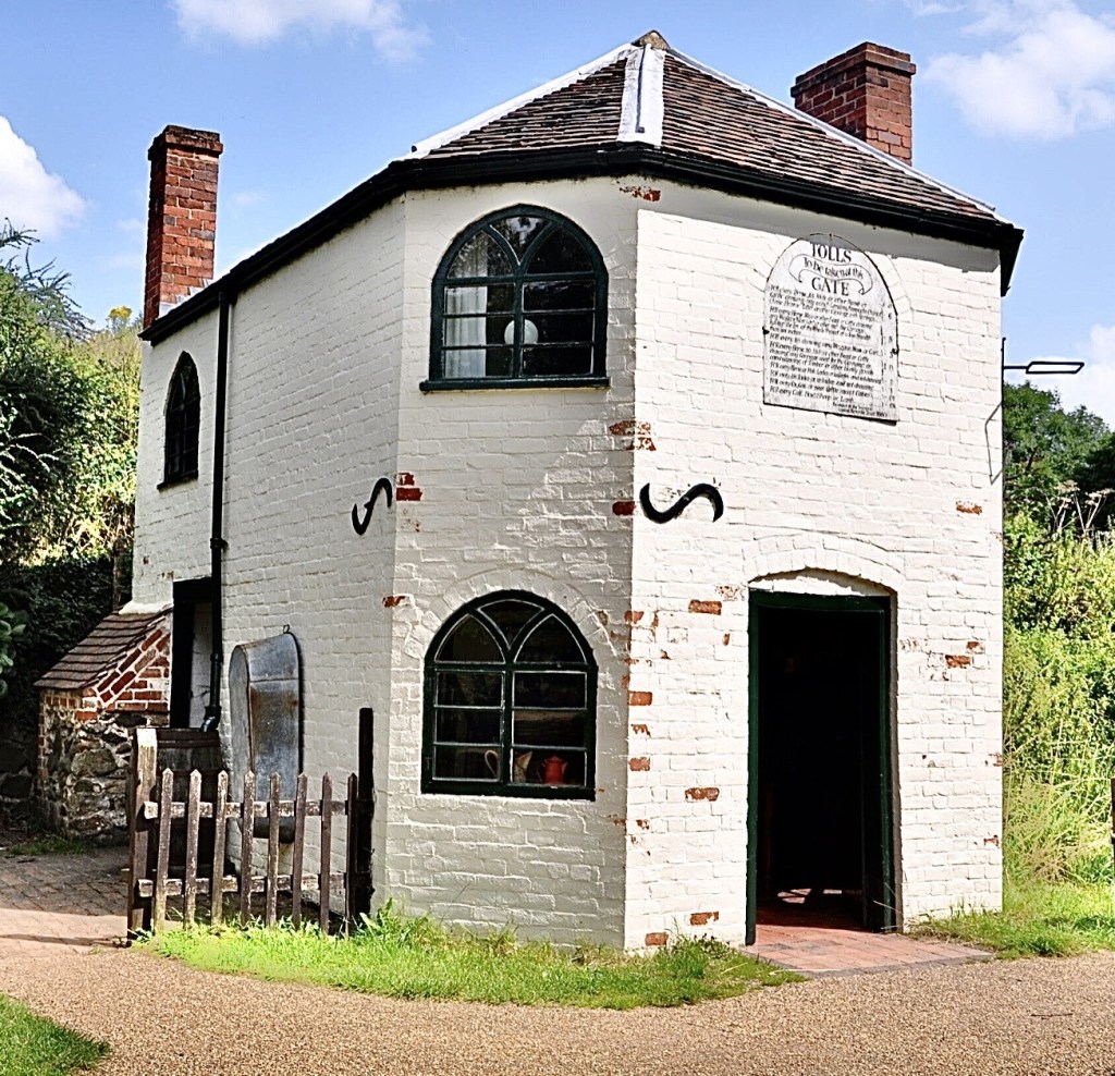
The toll charge board currently on the front of the house is a not the original but a reconstruction, however, it is typical of the standard type of board that would have been displayed in the purpose built, arched niche in the front facade brickwork.

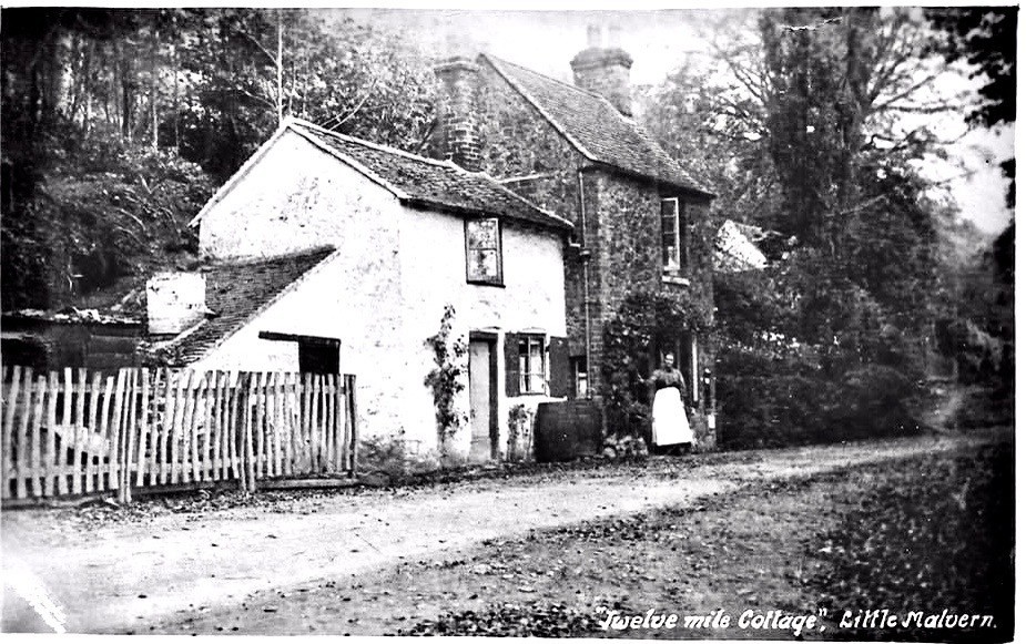
Twelve Mile Gate Cottage (see map for the location of the building, now demolished) was so called because it was exactly twelve miles from there to Worcester Cross, which is the crossroads right at the top of Broad Street, at its junction with High Street, St. Swithin’s Street and The Cross. Twelve Mile Gate Cottage had no electricity or running water, but it did have two gas mantles in the downstairs front room. The outside wall of the front room had a post box built into it. An outside privy was not uncommon then, but theirs was on the other side of the road, down some quite steep steps and several yards further on into the large garden area. 

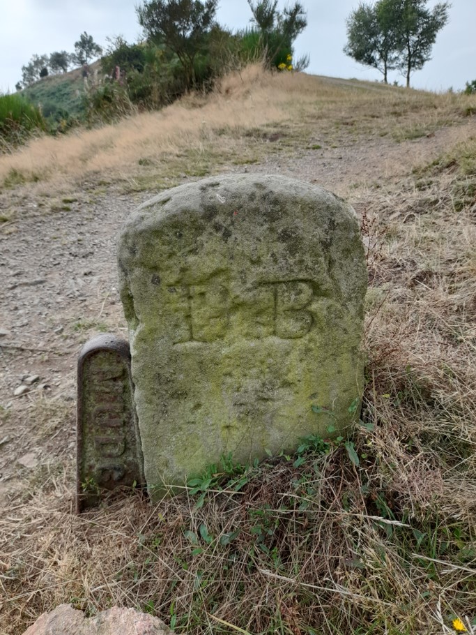
Milestones were erected by the Turnpike Trusts and can still be found along many roads.  Only one in the parish of Welland still has its cast iron plate (see image below) although there is another just outside the parish, on the A4104 Welland Road by Lower Hook (see map).  Both were erected by Upton’s Trust and have since been designated Listed Monuments by Historic England.  Welland’s is on the Marlbank Road just west of the crossroads (see map). There are two other milestones along the A4104 in Welland but these no longer have plates (all three are marked MS on the map).

Danemoor Ponds

Danemoor Coppice is still marked on Ordnance Survey maps as a narrow strip of woodland between Danemoor Farm and Wood Farm (see map). A stream runs through it and there is a large pond at the eastern end. Patrick Campbell grew up in Welland in the 1930s and 40s and writes here about his memories of Danemoor Coppice, ‘Jones’s Wood’ as he knew it, when old fishery ponds still existed and the woodland was more extensive.

A series of fascinating images was recently posted online* by John Clements, whose family, close friends of my forebears, has farmed for generations at Brotheridge Green near Upton-on-Severn in South Worcestershire. The individual plates in an illustrated catalogue from William Burgess & Co, dated 1897, include photographs titled ‘View of Pheasantries at Malvern Wells’ and ‘Danemoor Ponds: Malvern Wells Fishery’, as well as earlier price lists of livestock, guns and line drawings of a wide variety of fiendish metal traps – including ones for poachers. All supplied by Wm. Burgess & Co, the proprietors of these twin establishments and self-proclaimed ‘Sportsmen’s Universal Providers’.

I say ‘fascinating’ because these pictures and price lists provide concrete evidence as to how the country landscape of this corner of England has changed over the past century and how, in a wider sense, we have become more humane and more considerate in our dealings with the natural world. Having said that, we have lost so many birds and beasts and so much of their habitat along the way, that there is nowadays no need for the hawk, kingfisher, heron, polecat and mole traps which Wm Burgess advertised with such enthusiasm. Of the eighty odd birds listed in his brochure as protected – and no raptor is included – a number are now threatened in the UK, including the quail, the bittern and the corncrake. Even familiars such as the barn owl and cuckoo are endangered.

I can offer no personal reminiscences about the pheasantry. Though it was sited on land adjacent to the fisheries – and the familiar outline of the Malvern Hills dominates the backdrop – it had, in my childhood, long since vanished: indeed, the sighting of a pheasant was always something of an event.

I had earlier encountered Danemoor Ponds on one of my many hikes around the countryside. It was, I recall, a hot July day, and I emerged from the tenebrous south end of Jones’s Wood to a most unexpected scene – five large, symmetrical expanses of water separated by narrow grassy dykes and fringed by alders, willows and reed mace. Beneath the surface of the last pool was something I had never seen before – long, subterranean shapes motionless in the warm upper layer of water. I threw a stick and they moved languidly. Pike. Big pike. Maybe ten or more pounds. The fiercest of British fishes. Confirmation soon came. There, high and dry in the willow herb, was a very dead pike that had maybe jumped out of its watery element to escape the jaws of hungrier brethren.

I later became close friends with Richard Lloyd whose father Tom owned Danemoor Farm, the site of these ponds. They marked the northern boundary of a two hundred acre estate, fed by a small rivulet that issued from a roach-stocked pool higher up on Henry Jones’s land at Wood Farm in Upper Welland. This brook snaked across open fields, entered the wood, and emerged again to flow into the first of the watery expanses.

That the five ponds were symmetrical was pretty obvious proof that they had been excavated manually, with a view to creating a commercial fishery. But the stratagem had not endured, at least not in the long term. What was a flourishing Victorian cottage industry that had won national awards as long ago as 1885, had now, sixty or so years on, reverted to nature’s embrace.

Nonetheless, the ponds still existed, now rented by the Severn River Board from the Lloyd family for the princely sum of £35 a year. The Board was probably responsible for dividing the original three into five and adding links between each stretch of water in the form of wooden sluices to control the flow. And as Richard points out in a helpful recent note, there were four valves to monitor the levels in each pond as well as a pipeline below the ponds which diverted water back to the stream.

It all sounds like an efficient arrangement. But the commercial heyday of the fisheries had obviously long since gone – the presence of rapacious pike was evidence of that. In a detailed description of the fishery in its prime, William Burgess’s brochure indicates that the original inhabitants had mainly been brown trout (salmo fario), not easy fish to breed. The ‘Fish Culture Establishment in Malvern Wells’ which appears to contain at least sixty tanks, was where it all started. Designed for ova and newly hatched fry, the young trout were then transferred from the hatchery to ‘a series of ponds’ (the Danemoor fisheries), up to ten feet deep, and designed specifically for ‘fry, another for yearlings and another for older fish’.

In an interesting aside, potential clients are informed that a railway station is conveniently close at hand, but counsels that ‘it is highly important that a suitable conveyance (on springs) should meet the train in which fish arrive, as delay at railway stations is often fatal owing to water not being kept in motion.’ Agitated water obviously meant oxygenated water. A precious cargo destined for the streams, lakes and tables of the hunting-shooting-fishing aristocracy of rural England.

The Burgess catalogue offered for sale – in addition to its staple of brown trout – perch and goldfish – presumably kept in separate conditions – ‘levenensis’ (sea snails with attractive shells from Madagascar), ‘fontinalis’ (willow moss, an aquatic plant for both cover and oxygen), and yearling ‘irideus’, rainbow trout not native to these isles, and presumably acquired from another source. The small print of patrons – perhaps one should say large print – is revealing: headed by Her Majesty the Queen and HRH the Prince of Wales, the impressive list of clients includes around 400 marquises, earls and other members of the English great and good.

Back to my childhood and the fish ponds. The word was out among my village pals that a mallard was nesting there, and since we were all avid egg-collectors, I decided on a sneaky search. It took all afternoon to find the nest, which was not, as I had expected, among the reeds, but in the crown of a pollarded willow. The pike had now gone, but I did note from a tell-tale ‘plop’ that a water vole had perhaps taken up residence. As for trout, no sign.

But there were brown trout in the vicinity. Less than a mile away was Marlbank Brook. It issues from springs in the granite outcrops of the Malvern Hills, cuts a deep swathe across Castlemorton Common and through Welland village, and eventually joins a larger confluence at Longdon. And it was home to trout. Not many and no great size, but beautiful stippled brown trout that I occasionally winkled out from the alder roots. I had often speculated as to how they had arrived there. And now perhaps I had an inkling. Though the brooks did not connect, someone who owned a stretch of stream had maybe popped a few in from the fishponds.

The confessional coda to this tale is both dispiriting and encouraging. Richard owned a 16 bore shotgun, and as teenagers we shot hares and wild duck from the cover of the grassy banks and sallies of the ponds. Next door, in Jones’s Wood we targeted woodpigeons, silhouetted against the night sky in the spectral winter trees. On the grassy pasture that was once home to pheasants, a covey of English partridges would whirr away in alarm, aware of our intentions. As far as I can recall, they survived.

Such activities and attitudes have long been in the past tense. When Richard left Danemoor Farm, having earlier inherited the estate from his father, the new owners decided to demolish the ancient broad-leaved woodland that was Jones’s Wood. No need for shotguns. Certainly no need for hawk or polecat traps.

* Malvern History Facebook page

Kinley Cottage

Kinley Cottage is an attractive house faced with Malvern stone on Upper Welland Road (see map). It is not obvious from its current appearance that it was built as a school.

St Wulstan’s Catholic Church on Wells Road opened in 1862 and a small elementary school for the local Catholic children was built next to it. This needed replacing by the 1890s and so a new one was built on a site in Upper Welland Road given by Mr Charles Michael Berington of Little Malvern Court. The building costs were funded by voluntary subscriptions and the builder was Mr McCann of Malvern. The school opened in 1897 with Miss Lissie Craig as mistress. The school was intended for up to 50 children but average attendance was often lower. There was a large garden for the children, with separate male and female toilet blocks at the end of it.

St Wulstan’s School pupils 1915
St Wulstan’s School pupils 1920

Other schoolmistresses whose names have survived are Miss Helen McConn (1904), Miss Barlow (1905), Miss Floreen Pugh (1908), Eva Marion Breeze (1921) and Miss A Ryan (1928). During or just before Miss Pugh’s time, the number of places was reduced to 40, possibly to make space to provide living accommodation for the teacher.

The number of pupils continued to fall and the school closed in 1934. After this, local Catholic children either attended St Joseph’s Catholic School in Malvern or what is now Malvern Wells C.E. Primary School on Wells Road.

By 1939 the former school was occupied by the Woodman family and had acquired the name Kinley Cottage. The head of the household was Arthur Woodman, retired hotelkeeper, who had run the Portland Hotel in Church Street, Malvern, for many years. The other members of his household were his wife, Gertrude, who was blind, widow Alice Tilley, and the Woodmans’ adult daughter, Alice. She recorded her occupation as ‘unpaid domestic duties and care of aged parents’. Better known as Alys Woodman (1897-1987), she was also an artist of some note, who regularly had work displayed by the Royal Birmingham Society of Artists.

During World War II, Alys was a member of the local air raid patrol. She captured a German airman from a crashed bomber during the early hours of one morning in July 1942 when returning home from her ARP duties. Someone who knew her noted that she habitually dressed in dungarees and that might explain why the German airman thought initially that she was one of his crew and addressed her in German.

Alys Woodman was also responsible for the mural that used to be in the Worcestershire Beacon cafe depicting ‘a fair field full of folk’, part of the vision of Piers Plowman.

By 1949 William Johnson, a timber merchant, and his wife, Beryl, were living at Kinley. William added the top floor to the cottage, improving the bedroom accommodation. He also fitted several doors that had once belonged to RMS Mauretania, having bought them at the auction of the ship’s furnishings and fittings in 1935. These are still in place.

The cottage has had a number of owners since then.

With thanks to Gwyneth Gill, Roy and Barbara McAdam, Frank Morgan.

Boundaries

There is evidence of boundaries in the Welland area going back to pre-historic times. It is thought that the shire ditch along the crest of the Malvern Hills may have originated in the Bronze Age, and British Camp marks the western boundary of the Iron Age Dobunni tribe.

The Shire Ditch

Anglo-Saxon Charters

The first reference to Welland as a named place with boundaries is not until Anglo-Saxon times. The first documented reference states that the village, together with Upton, was given to the Bishop of Worcester by Mercian lords in 889, perhaps as part of their support for the developing Christian church. This charter does not have any documented boundary clauses but there are two other local charters from the tenth century that do: Longdon of 972 and Upton of 962. These give us at least a partial view of Welland’s outline where the boundaries are shared. Natural features form a large percentage of landmarks chosen to mark estate boundaries. Where these are streams they form relatively stable features in the landscape but references such as “the crooked oak tree” (mentioned in the Upton charter) less so. Nonetheless, reviewing the charters enables an educated estimate of the eastern and southern boundary. It also strongly suggests that Mere Brook formed the northern boundary. Thus, much of the Anglo-Saxon boundary remains in today’s parish outline. However, there is little evidence of the line of the western boundary.

Perambulations

Before detailed maps came into existence, the local community would undertake an annual perambulation (beating of the bounds) in order to maintain the boundary in the shared memory. Knowing the exact boundary was important to a parish community – to avoid trespass, to provide for the poor (and not someone else’s poor), for taxation, tithes and land ownership. Welland and Little Malvern are fortunate in having a number of documented perambulations, so detailed that even the amount of food and drink consumed during them was written down. In 1810, this was 11½ pounds of bacon, 5½ pounds of cheese, 19½ pounds of beef, 14 gallons of cider, and 11 gallons of porter (stout). Following the boundary was done so thoroughly that this sometimes entailed rather odd behaviour – the 1828 perambulation clearly states that the community walked through Bakehouse Farm pond and then through Bakehouse Farmhouse, as both straddle the boundary between Welland and Castlemorton. What the owner thought of wet and muddy people tramping through his house was not documented.

Disputed Boundaries

It was quite unusual for perambulations to be written down and they have survived for only a small number of parishes.  We are fortunate that we have a collection of three for Welland and twelve for Little Malvern from the 18th and 19th centuries.  The fact that they were written down is indicative that something was amiss.  A comparison of the perambulations shows that a considerable portion of what we now know as Little Malvern was a source of dispute between Little Malvern and the parishes of both Welland and Castlemorton. Those on the perambulations were accused of breaking down fences and trampling crops. Many of the issues can be linked to a description of the boundary of Welland made in 1648, produced during the turmoil of the civil war. It excluded any access to the hills, which seems to have been an ancient right.  There were numerous efforts to resolve the dispute (which cost the respective parishes a considerable sum) and was only finally settled in 1850.  Formalising access to the hills was important as it gave access to extract the stone – Berington Quarry is the legacy of this. 

Boundary Markers and Maps

It was not until the nineteenth century that detailed maps were created that marked Welland’s boundary. The earliest we have found to date is the Christopher Greenwood’s 1822 map, and by 1850 the Welland tithe map had been published. However, each of them still struggles to define the western boundary. Prior to the detailed Ordnance Survey maps being produced from the 1880s, a variety of posts and boundary stones were used to delineate the boundary where it did not follow a stream – several of these can still be found on the disputed western edge.

Boundary marker on the hills.
“MUDC”: Malvern Urban District Council
“DB”: defined boundary
Boundary marker in property wall.
“WELLAND DB 1858”

Boundary Changes

Following the passing of the 1894 Local Government Act, civil parishes were created as separate entities to ecclesiastical parishes. As a consequence, Upper Welland was transferred from Welland to Malvern Wells civil parish in 1898. However, the equivalent change for the ecclesiastical parish, though discussed in 1915, was not completed until 1978. The civil parish and ecclesiastical parish are not exactly aligned so that a small section of Upper Welland is in one parish for civil purposes but another for ecclesiastical purposes.

Police Stations

Worcestershire Constabulary was founded in 1839 and in the following decades the ‘village policeman’ became a familiar figure all over the county. Welland had a resident police officer from at least 1847 to the late 20th century, with two houses being used as police stations during that period.

Before 1994 police officers were entitled to either free accommodation or a housing allowance, which helped with the frequent transfers from one post to another.

Yew Tree Lodge, Drake Street

In 1851 Sgt George Checketts was recorded as living at the ‘police station, Drake Street’. This was the house at Brookend now called Yew Tree Lodge (formerly Yew Tree Cottage or Fir Tree Cottage, see map).

The house was in existence by 1847, when it appears in the tithe records. It was one of two adjacent cottages owned by Sarah Green, who also owned the next door Slade Firs. To become a police station the cottage must have been provided with somewhere secure to hold malefactors overnight – quite possibly a shed in the garden.

The census returns show that some of George Checketts’ successors were John Cowley (1861), Richard Potts (1871), William Walker (1881), Charles Williams (1891) and Alfred Jones (1901).

When the two cottages were auctioned in 1892 they were described as ‘two substantially-built messuages with productive gardens’. The police station was rented from the then owner at a cost of £9 9s per year.

The Old Police House, Gloucester Road

The Davis family outside Welland Police House, Gloucester Road c.1914-1919

In 1905 a new police station was built on Gloucester Road (B4208) on land only enclosed from Welland Common in the 1850s (see map). This stretch of road had few houses along it at the time and the police station would have had fields either side at first. Perhaps the Drake Street police station was deemed to be no longer adequate or needed major repairs. Newspaper reports of the time indicate that Worcestershire County Council accepted the tender of Mr W James of Bromyard for the sum of £548 10s to build Welland police station.

By the time of the 1911 census Sgt George Cook was living there with his family.

Information from the General Valuation Survey visit of 1914 reveals that the house had a kitchen, parlour, back kitchen and one cell, with three bedrooms upstairs. Outside were a brick coalhouse, water closet, pigsty and water pump. Worcestershire County Council owned the house and the market valuation was £580. At this time Sgt Davis was the occupier. According to a villager in the 1940s, the cell had metal bars across the top rather than a roof.

Later police offers included Leonard Taplin Crawford (1921), Ernest Pratley, (1939 National Register), Jack Rogers, Gerry Day and Dave Henderson. The house was sold in 1983.

The full list of police officers known to have served in Welland can be found here.

Thanks to Bob Pooler of the Worcestershire Police History website and Stuart Holland of facebook Malvern History Page.

War Memorial

Welland’s war memorial is on the green near the village hall (see map). It was installed in 2005 and dedicated on Sunday 8th May that year, the 60th anniversary of VE Day. There were already plaques in St James’ Church listing the war dead of the parish but the memorial, set amongst grass and trees, is visible to anyone passing.

The memorial consists of a slab of granite donated by the Malvern Hills Conservators (now the Malvern Hills Trust). Inset is a stainless steel plaque bearing the names of the men who died in World War I and II and the inscriptions ‘In memory of the men of this parish and former pupils of Welland School’ and ‘For your tomorrow, we gave our today.’ This was provided by the Friends of Welland and Little Malvern.

The dedication started with a church service led by the Revd Frances Wookey, vicar of Welland, at 11:00 am. Villagers and representatives from various regiments and the Royal British Legion then walked across to the green to complete the ceremony as shown on the photos. Refreshments at The Pheasant rounded off the event.

The Revd Frances Wookey, right, and Sue Richardson, lay reader for Welland and the Hanleys, left.
Many villagers attended the ceremony.
In the foreground: Gordon Bennett, Ray Ridley and Southwell Elms.

St James’ churchyard has three war graves, the headstones being provided by the Commonwealth War Graves Commission. These are the graves of: John Edgar Brown, d 1940, George Harwood, d 1917, and John Whittern, d 1915.

Photographs of the dedication ceremony courtesy of Bernette Arrowsmith, taken by the late Mary Purser. A folder kept on the Welland Library shelves in the village hall holds more photos of the installation of the memorial and the dedication ceremony, together with biographies of our war dead and their burial locations.

Physical Landscape

View of Welland village from British Camp, with the Severn & Avon Vales and Bredon Hill in the distance

Welland lies in what Natural England refers to as the Severn and Avon Vales Character Area. Landscape character is the distinct, recognisable and consistent pattern of the landscape which gives an area its “sense of place”. Landscapes evolve over time as a result of natural and cultural processes: natural processes create the physical structure of the landscape (geology, land form and soils), whilst cultural processes give rise to varying patterns of tree cover, field boundaries, settlement and routeways.

Welland lies on the land between the River Severn and the Malvern Hills, nestling at the point the land starts to rise. These two distinctive features have helped define the village, both its context and the way it has developed.

To the west of Welland, the Malvern Hills rise steeply from the Severn Vale and form an ancient boundary with the lands to the west, topped by Iron Age hillforts at Herefordshire Beacon and Midsummer Hill.

The River Severn divides two sharply contrasting landscape areas.

To the east, the land is underlain by Lias clays with occasional Cotswold oolitic limestone outliers such as Bredon Hill, and the soil is heavy but fertile. The area is characterised by nucleated settlements, arable farming and orchards.

To the west, the land is underlain by Mercia Mudstones, with banks of overlying superficial deposits (click on the map to see the deposit descriptions in the link) created by the processes of solifluction and gelifluction, and the soil is poor wet silty clay, not conducive to arable farming. Land use is predominantly pastoral. Settlements are more dispersed and a pattern of small to medium sized fields with an intermingling of fields and open commons has arisen as a result of piecemeal enclosure of the heathland from medieval times onwards.

In Welland, much of the west of the parish was part of Malvern Chase from the time of William the Conqueror, and land use was subject to strict forest law.

Common rights of grazing led to development of heathland but, prior to this, the area would have been heavily wooded. Although woodland is now sparse, there is still a relatively wooded feel to the area because of hedgerows and frequent hedgerow trees, together with remnants of orchards and trees in watercourse valleys.

Larger regular shaped fields in Welland are the result of late enclosure of common land which took place in the 1850s. Some of these are now used for arable farming, such as rapeseed. The enclosed landscape is characterised by rectangular fields, straight roads and small blocks of planned woodland.

Enclosure Act fields and road, Danemoor Farm to Hook Bank

The contrasting landscapes on each side of the Severn may be one reason why Welland was part of the Bredon manorial estate in medieval times. Having parts of manor land on each side of the river meant that different landscapes could be exploited for different agricultural purposes – arable on the east bank, woodland resource management and grazing on the west, perhaps with some seasonal movement of animals from Bredon to Welland to take advantage of summer grazing.

Although Welland fits the general description of the area’s historic settlement and land use in some respects – such as examples of dispersed settlement over the parish, and assarted land to the west of Welland – there is also evidence of the common field system of crop rotation more associated with the area east of the Severn. Certainly, there were still remnants of three fields worked in common at the time of the Enclosure Act of 1851. There is evidence of ridge and furrow ploughing across much of the parish’s land that lay beyond the boundary of Malvern Chase and some evidence for as many as five grain mills in Welland and Little Malvern, a further indication that villagers were able to grow arable crops despite the paucity of the soil.

The area west of the Severn is characterised by settlements linked by a network of lanes, many leading from the river in the east to the higher ground of the west, some used for centuries as drove roads. This long-term use is especially clear where routeways have gone over higher ground and created deep cuttings over time (such as the A4104 as it passes through Marlbank north of the village.) Drake Street takes advantage of a natural gap in higher ground created by the Marlbank Brook and wayside dwellings, strung along the street at the heart of the village, nestle alongside.

Traditional building materials such as local stone and occasional Cotswold stone can be seen in older buildings throughout the area, though many are timber framed, sometimes with their original thatched roofs. Later houses are made of brick – older examples may have had their bricks made on-site using local clay.

Welland has several landscape areas that are protected or notable in one way or another. Part of the parish lies in the Malvern Hills Area of Outstanding Natural Beauty (AONBs are now known as National Landscapes) and there are several Sites of Special Scientific Interest (Mutlow’s Orchard, part of Brotheridge Green disused railway) or Sites of Regional or Local Wildlife Importance (Drake Street Meadow).

Mutlow’s Orchard with native narcissi

20th Century Housing Estates

During the 20th century three housing estates were built in Welland, all on land that had only been enclosed from Welland Common in the 1850s. (Housing estates in Upper Welland will be covered in another article.)

Marlbank/The Avenue

The first council houses appeared in Welland in the 1920s when six pairs of semi-detached houses were constructed on the A4104 Marlbank Road at the western end of the village (see map). They had no electricity – Welland did not get an electricity supply until the 1930s. Nor were they fitted with running water – each pair of houses had to share a pump.

More council houses and bungalows were built on the land behind these six in the 1930s and post-war years, forming the roads now known as The Avenue, Brookside and Chestnut Close. The estate is roughly triangular, bounded by the Marlbank Brook, the A4104 and the cemetery and Welland House.

The Avenue estate from Marlbank

A number of tenancy agreements from the 1950s and 60s in the archives at The Hive reveal that the rent for a house in 1952 was 12/- per week. A rent collector called on Mondays. Tenants had to agree to abide by a list of regulations including keeping the property clean and in good order, reporting problems to the council promptly and requesting permission before decorating or putting up a garden shed. One week’s notice was required to quit the property. All these documents still refer to the houses as ’23 Marlbank’, ’27 Marlbank’, etc. At this time Upton Rural District Council owned the properties, which amounted to more than 50 by the 1960s.

Malcolm Brookes and his family lived in one of the original council houses on Marlbank Road, no. 6, now no. 8. His maternal grandparents, John and Ada Stanley, moved into no. 6 when it was built, together with their daughters Florence and Edith. John died not long before Edith married Harold Brookes in July 1927, leaving Ada, Edith and her new husband to share the house. It remained the Brookes family home until 2013. Malcolm has written the following account of life at no. 6. The track between nos. 6 and 7 that he mentions was to become The Avenue later as more houses were built.

As far as I know there were only 12 council houses on Marlbank Road in the mid-1920’s. Garrett Bank can be clearly seen in Edith and Harold’s wedding photo. These six pairs of semi-detached houses had just a rough track to farmland between nos. 6 and 7. The council houses had sizeable gardens and at no. 6 my family grew vegetables and flowers, kept chickens, ducks and pigs and my father, Harold, also kept chickens on an adjacent allotment.

The track (which, in my early days, was known only as the lane) was adopted as an access to more properties, possibly those built in the 1930s. This development was further extended in the 1950’s with yet more semi-detached houses/bungalows.

Again, in the 1970’s, or thereabouts, an ‘in-fill’ pair of semi-detached houses was built by the brook (numbered 1 & 2 Marlbank Road – hence the renumbering of the original houses) and cul-de-sacs of new bungalows were also built in the gardens behind these original council houses. It may well have been at this later time that the lane was signposted as The Avenue although I’m not certain. Obviously, the large gardens were considerably reduced in size to facilitate this last development and it was about this time that these old council owned houses were given a complete renovation.

My three older sisters were born at no. 6 in 1930, 1932 and 1934 and I followed in 1946. I can remember the house with no running water. Water was pumped from a well shared with the adjacent neighbour. The pump froze at times in the winter even though it was lagged.

The house had three bedrooms upstairs and a hall, kitchen and living room downstairs. There was no bathroom. The toilet and coal house were outside in a separate brick building. We had to use a bucket of water from the pump to flush the toilet. it was an extremely cold experience in the winter.

The kitchen had a gloss-painted brickwork interior, lino on the floor and there was a coal-fuelled range cooker/oven with an adjacent coal furnace under a washtub. Usually on a Sunday, when the range was hottest, we used a tin bath filled with hot water in front of the range fire in the kitchen to have a bath. Often, as the youngest child, I was the last to have a bath. On the north side of the kitchen was a larder with a cold stone slab but this was knocked out in the 1950’s. I remember our pig carcasses being hung on hooks up the stairs in the hall to cure.

Originally there was no electricity and the house was lit by oil lamps and candles. A radio was operated by a battery (an accumulator) which was taken to Roberts’s garage on the Gloucester Road, Welland, to be charged. I’m not exactly certain when electricity was put in the houses but there were many power cuts. Water was piped into the houses in the early 1950’s and it made a huge difference. With water plumbed in we had a proper bathroom with a flushing toilet and chain and in the kitchen we had a Burco Boiler for doing the washing and the old range was replaced by an electric cooker. The property was further upgraded over the years and in about 1980 there was a full renovation of these old houses; walls were plastered and the downstairs bathroom was upgraded, central heating was installed and an upstairs toilet was put in.

As life was one of self-dependence in the early days at the house, a large garden was very important to provide vegetables and a food source throughout the year. Welland, of course, did have a bakery (or delivery from Pearce’s of Upton), and I believe there was a butcher’s. The post office moved location a few times, and before the Co-op deliveries, you could buy a jug of milk from Laddie Bishop from Bishop’s Farm (Duckswich Farm, Upton), who delivered milk by horse and cart.

During WW2 the family regularly saw the American soldiers, based at St. Wulstan’s, Upper Welland, passing by and sometimes they would stop and give sweets or gum. My family also housed Land Army girls during the war and one or two kept in touch after the war ended. Sharing bedrooms just had to be accepted during this time.

There are many stories that can be recounted of my family’s lives at this council house over the years but I hope the above is of interest.

Welland Gardens

Welland Gardens, off the B4208 Gloucester Road (see map), consisting of 45 houses and bungalows, was constructed in the 1960s. According to a newspaper advertisement from July 1968, 24 houses were then in the process of being built and prices ranged from £4,350 to £4,650, with central heating as an optional extra.

A further six houses were added at the end of Welland Gardens to form Merryfields in 2001.

Welland Drive in the 1960s, courtesy Gordon Baylis

Giffard Drive

The 1970 Welland Village Report written by the Worcestershire county planning officer included a map showing the area of fields south of the Marlbank Road as a ‘possible development site’. Giffard Drive, also referred to as Bishop’s Wood Estate, was eventually built in the early 1980s by Bovis (see map). The estate has a variety of detached and semi-detached houses and bungalows numbering more than 100 dwellings in all.

Giffard Drive and the closes leading off it were named after bishops of Worcester to commemorate the fact that for much of its history the manor of Welland was owned by the bishopric. The reasons for choosing these particular bishops are unknown at present. Most are from the 13th and 14th centuries: Thomas Cobham, William Gainsborough, Godfrey Giffard, Adam Orleton and Walter Reynolds. Walter Blandford was bishop in the 17th century.

The site was planned to allow for some existing trees to be kept. A number of large oaks on the estate are survivors from the former field boundaries and a fragmentary section of hedge also remains.

Oaks and hedge in Blandford Close
Oaks, Giffard Drive

Interestingly, the 1970 report suggested footpaths be included to connect the estate to the A4104 opposite what are now Lime Grove and Cornfield Close, and the B4208 near the shop, but these were never built.

Upper Welland Methodist Church

Welland’s 1847 tithe apportionment refers to a “House and Wesleyan Chapel” on the site of the present Chapel Cottage[s] (see map). This has caused some confusion with local historians as the building was described as a “School Room” and the denomination as “Independent” by the owner in the 1851 Ecclesiastical Census and had been such for some years. We can find no suggestion that this site was ever Methodist.

The earliest reliable reference we can find to Methodism in the area is in the Newent Circuit plan for June 1837, to the Malvern Wells Society (with two members.) At Midsummer 1840 the list of Societies included Welland (four members, leader W. Hart).

We find a reference to Mr Deveaux of Welland giving £1 towards the expenses of erecting a chapel of Birtsmorton, which was opened in 1844. And in December 1840, James Etchells, who was the Circuit minister based in Ledbury, registered the home of Robert Devereux (Mr Deveaux?), who was a shopkeeper at what is now known as Holdfast Cottage (see map) as a “place of religious worship”. There would have been regular preaching there, although this must have happened for only a relatively short period as there are no Wesleyan meeting places in Welland in the 1851 Ecclesiastical Census and Robert had moved by then. By Michaelmas 1847 the Welland Society had disappeared from the records. The societies were very fluid in those days, appearing and disappearing over the years as membership waxed and waned and was absorbed into other nearby societies.

The Malvern Circuit came into being in 1863 and there will have been a repositioning of Societies into the new circuit. In 1873 Malvern Wells is listed in the new circuit, meeting in a dwelling house and having 20 sittings.

By July 1877 conversations had begun to find a more suitable place for worship and by July 1878 land had been purchased at “Malvern Wells” at a cost of £30, the site of the present Methodist Church (see map). However, circuit records show that the circuit came under financial strain “greater than it can bear” and in 1885 the land was transferred to the Ledbury Circuit “in order that the building of a chapel may be proceeded with in connection with that circuit.” The chapel did not return to the Malvern Circuit until 1973.

The trust deed for the Malvern Wells was signed in 1878 (eight years before the building was erected). Thomas Chadney & Son were the builders. Chadney had been listed as the Society leader in the return for December 1886 and T. Chadney appears as the first Trustee. Appropriately enough his skill is listed as “builder”. It is clear that he was instrumental in building the present chapel at Upper Welland as we have a newspaper evidence of June 1886 of him getting fined for leaving chapel building materials on the highway!

An article in the Malvern Advertiser of the time of the chapel’s opening described it as “a neat but unpretentious structure of brick, with stone facing, and is to accommodate 120 persons.” Pevsner’s guide to the buildings of Worcestershire includes a listing for the chapel and notes that its brickwork has “ample yellow and blue trim; round-arched openings on the entrance front, pointed side windows.”

Postcard c.1910. The Methodist Church is on the left. Postcard courtesy of Malvern museum

It was not until 1923 that the Society is first referred to as “Malvern Wells (Upper Welland)”. Between 1947 and 1951 this changes again to “Upper Welland (Malvern Wells)”. The majority of the members of the society in 1905 did not live in Upper Welland. By 1920 all of them lived in the village. This perhaps gives some justification for the subtle change of name of the society on the plan in the 1920s.

The first wedding was held at the chapel in 1936 between Winifred Davis and Frederick Bullock. 

A schoolroom and vestry of corrugated iron were added sometime in the 1920s. In the early days the Chapel was heated by means of a tortoise stove using coal and coke. The original lighting was by gas, with electricity arriving in 1924. Mains water came to the chapel in 1978/79 followed by a kitchen installation and flush toilets.

The development of Upper Welland Chapel was, like many non-conformist churches, enabled and supported by individuals. In 1976 Mary Tibbles (church pianist) donated a piece of land to the rear of the building and another to the east in 1992 to enable a rebuild of the school rooms and vestry area. Major renovation work on the chapel itself also took place. The church hall is dedicated to Margaret Davis, long term member and supporter of the church.

The church is still active, with worship services every Sunday morning at 10:30am.

Upper Welland Methodist Church today

Note: “Welland, Lower Hook” Methodist chapel was erected in 1894, an iron chapel with 100 sittings, but this is clearly stated as being in the parish of Upton upon Severn so is not actually a Welland church. The last act of worship took place there on 26th July 1903.