Old St James Church

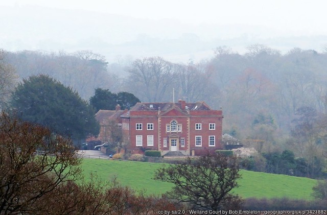
The first St James Church was at the end of Welland Court Lane, surrounded by a small graveyard (see map) and next to Welland Court. The ‘chapel of Wenlonde’ was in existence by 1288 and had been granted the status of a church by 1340 but we know nothing about this structure. It may have survived until the 17th century or been replaced during the interim. There was certainly a rebuild in 1672, according to a plaque that once hung in the chancel. The tower is thought to have been re-built in 1738.

Old St James’ Church, Welland, painting by Mary Brandling, 1856. Photo by Philip Blackman. Original painting in Malvern Library. Copyright holder (if any) unknown – please contact us if you want the image removed.

Most of the seats had to be paid for on a yearly basis and the major landowners were allocated specific pews. A plan of the seat allotments from 1829 shows that each seat contained two kneelings and the charge was three shillings per kneeling. But half of the allotted seats seemed to have no occupiers at the time, e.g. ‘Late Bullocks & Late Hewitts’, ‘Late Lulwitch & the Pheasant’. Eleven pews are listed for the south side and eight for the north side, where space had to be left for the pulpit. There was room available at the back of the church for those who did not pay for their seats. The church could accommodate only about 150 people.

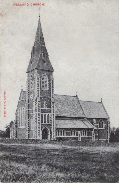
A new church was consecrated in 1875 at the crossroads of Drake Street and the Gloucester Road and the old church was then demolished.

Local artist Mary Brandling was one of the last people to be buried in the old churchyard in 1873.

Photo: Philip Blackman

Today, a small metal gate gives access to the graveyard (looked after by Little Malvern and Welland Parish Council). Some gravestones survive but no trace of the church building remains. There is a slight depression in the ground marking the location of the chancel floor, under which a number of people are known to have been buried.

Photo: Bob Embleton, geograph-2876872

The only known description of the interior of the old church comes from the antiquary Peter Prattinton of Bewdley (1776-1840). He visited St James on 30 May 1820 and made detailed notes. He recorded that there were several monuments on the walls of the chancel and inscribed stones on the floor marking the burials of Archers and Taylors in the vault beneath. He noted the benefaction table, hanging over the chancel door. The pulpit hangings were white velvet with a red fringe and the royal arms of William and Mary. The tower had four bells dating from 1680, 1703, 1714 and 1721. He reported that the font was old and of stone, with three cherubims decorating the bowl. He also mentions a singing gallery, which must have been at the west end of the nave.

Waterways

No major waterways pass through Welland but, like most settlements in Britain, water has strongly influenced its development.

Welland is situated on the A4104, an old road linking Upton upon Severn with the pass through the Malvern Hills at British Camp and on to Herefordshire. The settlement is likely to have developed as a direct consequence of this link to the Severn, an important waterway for trade and travel. Links are traceable as far back as Anglo-Saxon times and likely go back much further.

There are a number of smaller waterways within the parish and several are used to form parts of the boundary, no doubt because they are linear, relatively stable and easily identifiable features in the landscape.

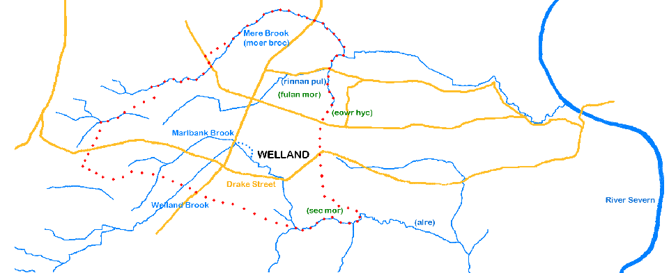
In the clay areas of Worcestershire, streams are plentiful enough to enable settlements to be sited near a water source and also have others as boundary markers. Thus, Mere Brook forms a substantial part of the northern boundary of the parish (parish boundary shown in red dots), whilst Marlbank Brook and Welland Brook go through the settlement itself. Marlbank Brook and Welland Brook join at the B4208 as it heads north out of the village (see OS map). The Brook then flows down to and alongside Drake Street towards Upton, before heading south to join other streams and enter the Severn further south. The Brook forms part of the south eastern edge of the parish boundary.

The importance of waterways as boundaries is shown by the fact that we have knowledge of the Anglo-Saxon names of several of the waterways, small as they are, because they are referenced in charters of the time demarcating estates. These names can be seen on the map below (in brackets after the modern name on the map). The names in green show other boundary clause topological features – fulan mor (foul marsh), sec mor (sedge marsh) and eowr hyc (yew ridge) – the first two hint at how much drainage has taken place as the area was subsequently developed.

At first sight, Welland appears a relatively flat area but a look at a combined LIDAR/aerial image shows the lumps and bumps of the topography. It looks likely that Drake Street and the village itself are sited where they are because the Brook has cut through a ridge to provide easier access up to the higher ground and the Hills.

A water mill is known to have been sited soon after the confluence of the Welland and Marlbank Brooks. In the 17th and 18th century this was known as Archer’s Mill but it is likely that there has been a mill at or near this location before then. Structural remains and the ghost of an access track can still be seen at the site and the remains of the mill leat can also be found (see map, mill leat marked with blue dots).

Tyre Hill Inn

From at least 1861 to 1911, the licence of the Tyre Hill Inn, opposite the Tyre Hill estate on Welland Road in the north of the parish (see map), was held by the Vivian family. In the census returns John Vivian described himself as publican or innkeeper and bricklayer. Following his death in 1889, his widow Elizabeth took over and then one of their sons, Andrew.

The Vivians had moved by June 1912 when the Evesham Standard newspaper reported that the landlord of the Tyre Hill Inn, William Morris, had been accused by two police officers of being drunk in his own pub. He was acquitted by the helpful evidence of several customers, but a month later a notice appeared in the Standard that the licence had been transferred to William Hinton.

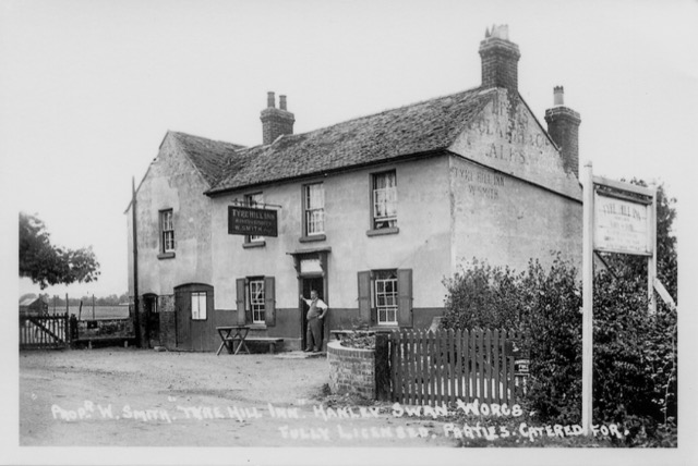
The 1928 Kelly’s Directory listed William Smith as proprietor and the postcard shown here dates from his time. The lettering on the gable wall reads ‘Lewis, Clarke & Co’, which was the name of a Worcester brewery.

In June 1938 Worcestershire Licensing Committee heard that Mrs Annie Elizabeth Smith, widow (presumably of William), held the licence at Tyre Hill but was referring it for compensation, i.e. she was prepared to close the pub in return for a payment. She reported that average trade was £15 per week and the premises were in a bad state of repair. It was probably at this time that it ceased to be a public house as it is not listed in the 1939 National Register.

It is a private residence today.